Showing posts with label Virginia. Show all posts

Sunday, January 13, 2013

EC Practice to Thimble Shoal Light


With the Watertribe Everglades Challenge getting near I went out today to put on some practice miles. The weather was warm with very little wind.


My destination was the Thimble Shoals Light House. The total distance was 26nM.


Saturday, October 27, 2012

Fishing Rudee Inlet

Last weekend I did some fishing with Cory Routh of Ruthless Outdoor Adventures.


It has been several years since I have taken any time to fish. I must make some effort to get back to this fun activity.


Monday, October 15, 2012

Rappahannock River Trip Pictures

This weekend did the Rappahannock River from Fredericksburg to Urbanna, Virginia. It was a slow painful trip. Both the wind and currents were agains us. The southeast wind were funneled along the long ridges straight into out face. Average speed was 2 knots. The scenery was spectacular.


Wednesday, October 3, 2012

Rappahannock River Trip Coming Up


October 12th I will be doing the Rappahannock River and lower Chesapeake with couple of Watertribers. We will start in Fredericksburg and run down to Grand View Island. I will have my SPOT on.

Saturday, September 1, 2012

Bucket List: West Neck Creek

As I approach the Double Nickel (55) this year I think about all the things that I always wanted to do and have never done.
==================================
When a fellow Watertriber Eric, e-mailed me about doing at least a part of his round Norfolk/VA Beach loop with him I declined due to work. Approaching lunch time I checked on his progress. Work was slower than expected. Meetings got canceled due to the three day weekend coming up. "What am I doing here that can't be done later". I decided on the spot to take off and meet Eric as he would pass the Princess Anne Boat Ramp. The West Neck Creek to the Lynnhaven River has been on my to do list for years now. It has been traversed only by a few people. This one a chance that I could not pass up.

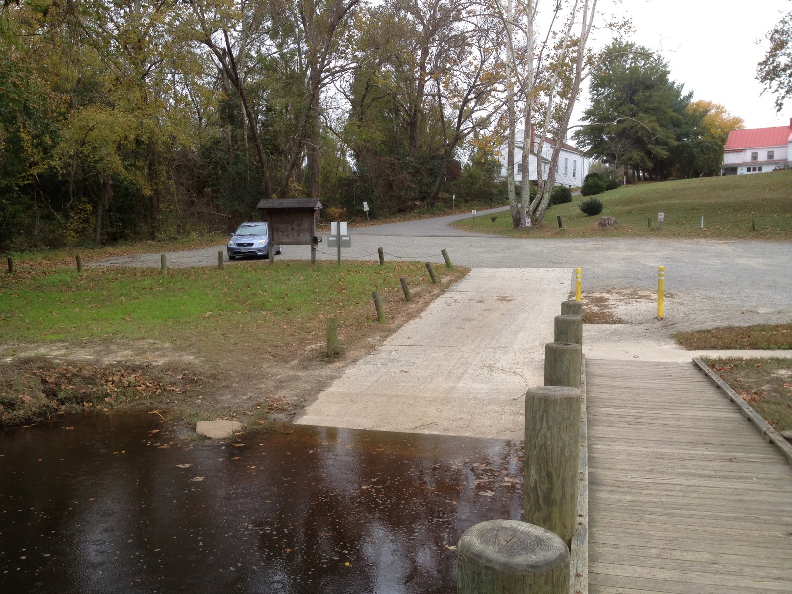
One hour to get home, load a kayak and get to the ramp. From past experience I knew that the West Neck Creek had a lot of submerged logs and weeds. A Hobie AI would tear up a Mirage Drive in these conditions. I took my wife's kayak because it was the easiest to grab and go.


I arrived at the ramp at 12:30. No Eric? The SPOT page does not pull up well on my i-Phone. You can not zoom in. I did not know if he had past or still not arrived. Looking at the green leaf matter floating on the Creek I determined that it had not been disturbed by any passing boats. I decided to  back track down the creek.


The creek was relatively clear for the first half mile from the bridge. The current was running up stream against me. I came up to a patch of clogged creek. The weeds started overtaking the area due to a number of logs that had dammed up the section. It took some energy to get through about quarter mile of weeds, logs and downed trees. Most of the smaller logs you can run over. I had to use a lot of hip motion to move the boat forward. When I got past the obstruction I still could not see any signs of Eric. I pulled over to the shore, or what could be considered a shore in the middle of a marsh.


While playing with my i-Phone, trying to figure out where Erick is, he suddenly came out of nowhere coming up the creek. He was glad to see me. Apparently the reason for his delay was that he came up on to the same obstruction earlier and thought that he was in the wrong channel. He had turned around only to find no other passage.


Together we crossed the barrier heading back up stream toward the Lynnhaven River...


Friday, August 31, 2012

SPOT Adventure around VA Beach

http://share.findmespot.com/shared/faces/viewspots.jsp?glId=0CvbfFdC5PWziytb9sP4S4FkuSMSWPhZL

A Watertriber WaitForTheWestWind is doing a 60 mile loop around Virginia Beach and Norfolk. Overgrown canals to come. This one is on my Bucket List. I am thinking of bailing out of work early and joining him...

Sunday, August 26, 2012

Photo Shoot on the Lynnhaven


Local photographer, Steve Earley asked Chris and me to take some picture on the Lynnhaven River for a magazine article that he is doing. Steve has a very nice Blog of his own, "The Log of Spartina" The morning started very early to catch the colors of the dawn. I brought my Tandem Island and my wife, Ruth. The weather was great and we all had fun. I have not seen the results...


Sunday, August 12, 2012

Grand View Round Island Race

The weather has been hot, close to a hundred degrees each day. During the Round island race there was very little wind. The Sunfish sailors suffered and only four finished.


Tuesday, June 19, 2012

GVI To Mockhorn Video


It has taken me some tome to publish the first video of the GVI to Mockhorn trip. Attached is the first part to Mockhorn Island.

Thursday, June 14, 2012

GVI To Mockhorn Island

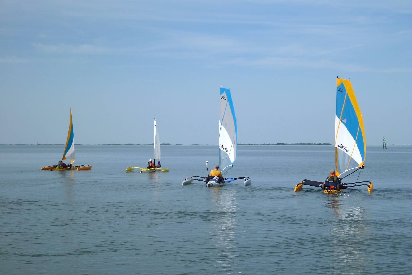
This past weekend there were three boats that left Grand View Island, in Hampton VA and sailed across the Chesapeake Bay to the Eastern Shore and a barrier island called Mockhorn. Sailed might not be the correct term since it was very calm and hot. There were three Hobie Adventure Islands, a Triac Sailing Kayak and a Prindle 18 Catamaran. In these light conditions the auxiliary power kayaks kept up with the big cat.

Two members were from Watartribe, the rest were practicing for the next North Carolina NCC event.


A Video Adventure will follow...

Tuesday, May 22, 2012

Back Bay Nor'easter


This weekend the winds were blowing much too strong from the North East. The Chesapeake waves were 4-6 feet. We decided to seek the more sheltered Back Bay, on the border of Virginia and North Carolina. This area has different challenges: shallow, choked with oriental invasive weed, with plenty of poisonous Water Mocassins.


Sunday, April 15, 2012

Sailing on Grand View Island


This weekend I went to Grand View Island to sail with some Sunfish sailors. We ran a couple of courses in windy conditions. The bay water temperatures are starting to come up.


Wednesday, December 7, 2011

The York River into the Chesapeake Bay


This is part 2 of our November Mattoponi/York River trip. In this part we leave our overnight campground and head down the York River to the Chesapeake Bay. The winds are 15-20 knots with temperatures in the 30's.


In the Chesapeake the waves got quite large. The winds drove us flying down the bay.


Wednesday, November 30, 2011

Going Down the Mattoponi

Two weeksago a fellow Watertribe member, WaterDog and I did the Mattoponi and York rivers of Virginia. It just happens that we picked the rainiest and coldest two days of November.


The Mattoponi River has some of the largest tidal differential on the Chesapeake. The four foot tides generate 2-3 knot currents going up stream. We fought the current most of the first day often doing only one knot down river.


The fog lasted way past noon often accompanied  with rain squalls. Even with a dry suit on it felt like we were swimming all day. The upper Mattoponi is very remote. We launched from Aylett the furthest reach of the tides. This is a very historic region with several homes from the 1700's. Before the day of steamers and propellers the settlers used the tidal currents to their advantage pushing supply boats far up the river.


 There even was a cabin from "Deliverance". The fog gave everything the special effect. The visibility was limited so each bend in the river held a new surprise.


Around 5 PM cold front came through dropping the temperature into the 30's. Along with the front came  more rain, lightning and wind. We needed the wind. A lot of miles were lost fighting the current. We were way behind schedule. The river has no navigational aids with few houses to mark the way. Once it turned dark I depended heavily on the GPS keeping to the center of the river.


I made two videos of the Mattoponi River: Enjoy...working on the York River part of the trip...


Saturday, October 29, 2011

Mattoponi and York Rivers

I have been thinking about doing another Fall River Trip.

Last year I did the James River from Richmond, Virginia to Portsmouth. A two night, approximately hundred mile trip.
http://www.youtube.com/user/dogslife23452#p/u/28/f0GGzPtA3CU


This year I am moving to the next major river on the Chesapeake watershed. The York river and it's tributary the Mattoponi River are very much different than the James.  The Mattoponi is considered one of the most pristine Rivers in the Mid-Atlantic Region. There is no industry until your reach the York at West Point. We will start at the upper tidal reaches at the Aylett public boat ramp. At this point the river is narrow with overhanging trees. We will either have to keep the Adventure Island mast down or hug the center of the channel.


The tidal range on this river can be up to four feet. This is some of the highest tides on the Chesapeake. When coming in it can run a couple of knots against you.  After Walkerton Bridge eight miles down, the river  opens up slightly. The tree lined banks fall back and open up to mashes. The Fall is a ideal time to view flocks of migrating birds.


At West Point, 32 nautical miles down, the Mattoponi merges with the Pamunkey river to form the wide York River. The south side of the York has high banks and bluffs. At low tide the shore line can be hard to approach due to the 1-2 foot water depth. After the York River State Park you can not land due to a number of Military Camps and Reservations.


On the other hand, the North side of the York River has large marshes. There are some Oyster beds shown on the nautical charts. The main channel does run closer and there may be a few small places to take out for a night camp. Google Earth is a great tool. But, it can be a little deceiving. Areas that look like sandy beaches can be under water at high tide. I might take a day trip and put in at the state park boat ramp to scope out this part of the river. Hugging the North bank is not only the most direct route but also the safest to keep you out of restricted areas.


The York River enters the Chesapeake 58 nM into the trip. To head South you can cut behind Goodwin Island trough the Thorofare. It is another 10 miles across the Poquoson Flats, along the Plum Tree National Wildlife Refuge to Grand View Island. To Hampton the total trip is about 74 nM. Cutting across the Chesapeake from Grandview to the Lynnhaven makes the trip about 86 nm.

My schedule is pretty tight. Trying to coordinate this trip with others might put me close to Thanksgiving. By that time much of the leaves will be gone and the weather will be cold, well into the 30's at night.